You can't diary the first trek of summer. You wake up one Sunday, realise you've been wearing short sleeves for a week, and the wind stopped biting sometime around the equinox. Skin's still winter-pale. Legs feel shorter than you remember. You drive up to Mġarr with an old water bottle that's half rinsed and the trainers you tried to retire in February.
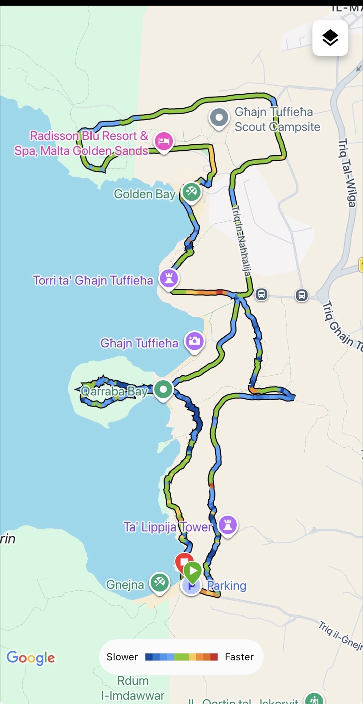
Today was that day. Ġnejna → Qarraba → Għajn Tuffieħa → Golden Bay, then back again. About 9 kilometres as a loop, done in roughly two and a half hours if you stop at every viewpoint. The most written-about coastal walk in Malta, and still — allura — the one most people haven't actually done end to end. [INTERNAL LINK NEEDED: related coastal walk or FLOR EXPLORES hub]
Start at Ġnejna. Everyone else gets this wrong.
If you google "Malta three bays hike," you get the same article in forty variations. They all start at Golden Bay car park, mention the path is clearly marked, and tell you to wear proper shoes. All true. Also useless.
Here's the bit nobody says: start at Ġnejna, not Golden Bay.
Everyone starts at Golden Bay because that's where the organised parking is. Then they hit Għajn Tuffieħa at the midpoint when their legs are already warm, descend the red-clay steps, arrive at Ġnejna too tired to enjoy it, take a photo of the fishing boats and leave.
Flip it. Start at Ġnejna (there's a small car park behind the beach, follow signs from Mġarr). Head up the hill, pick up the coastal path, walk it north. The clifftop between Ġnejna and Qarraba is the best stretch of the whole route, and you want your legs fresh to feel it. Golden Bay — the most commercial of the three — becomes the reward at the end.
That's what we did today. The instinct was right.
Qarraba Bay is the bit nobody tells you to do
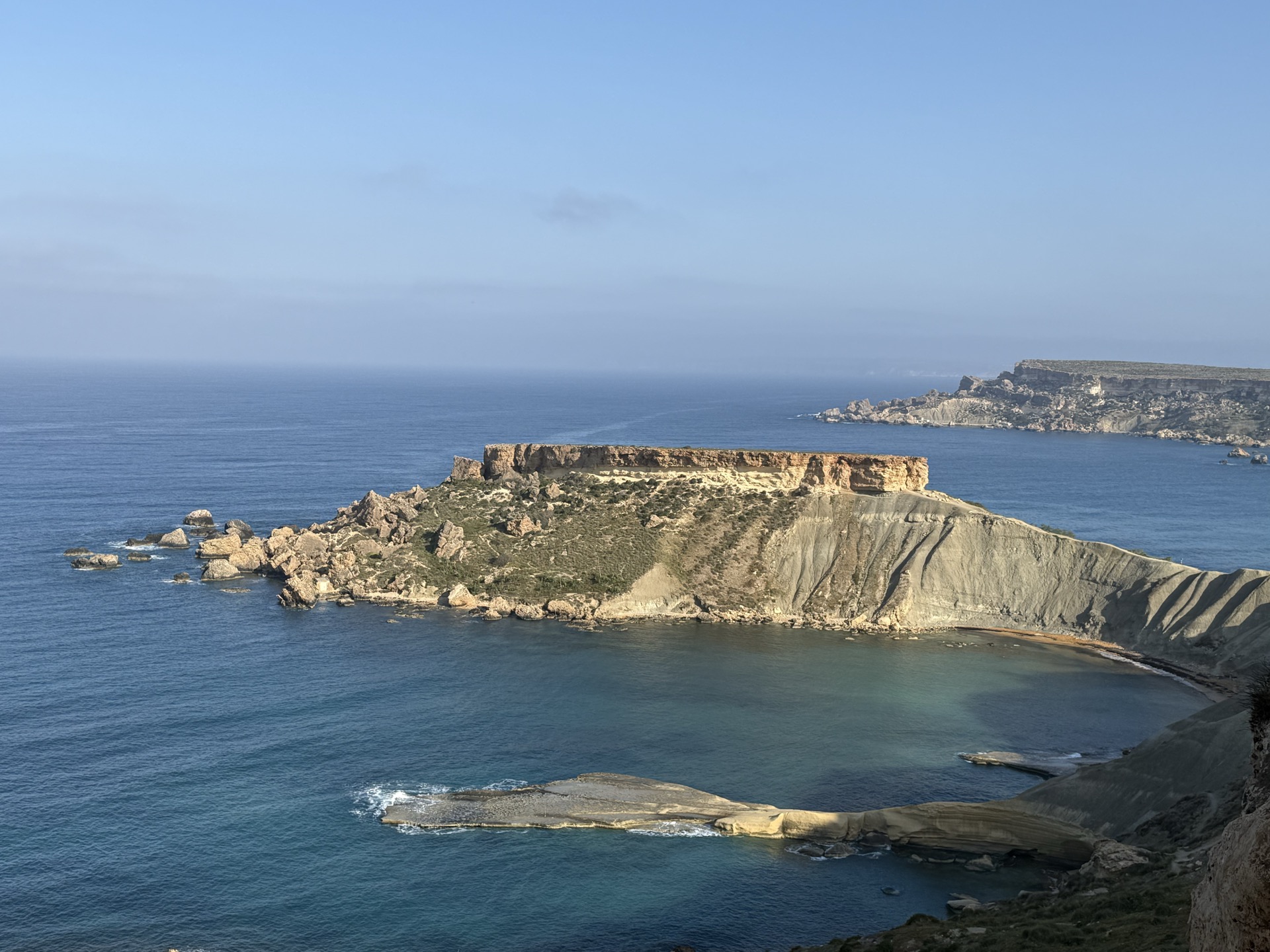
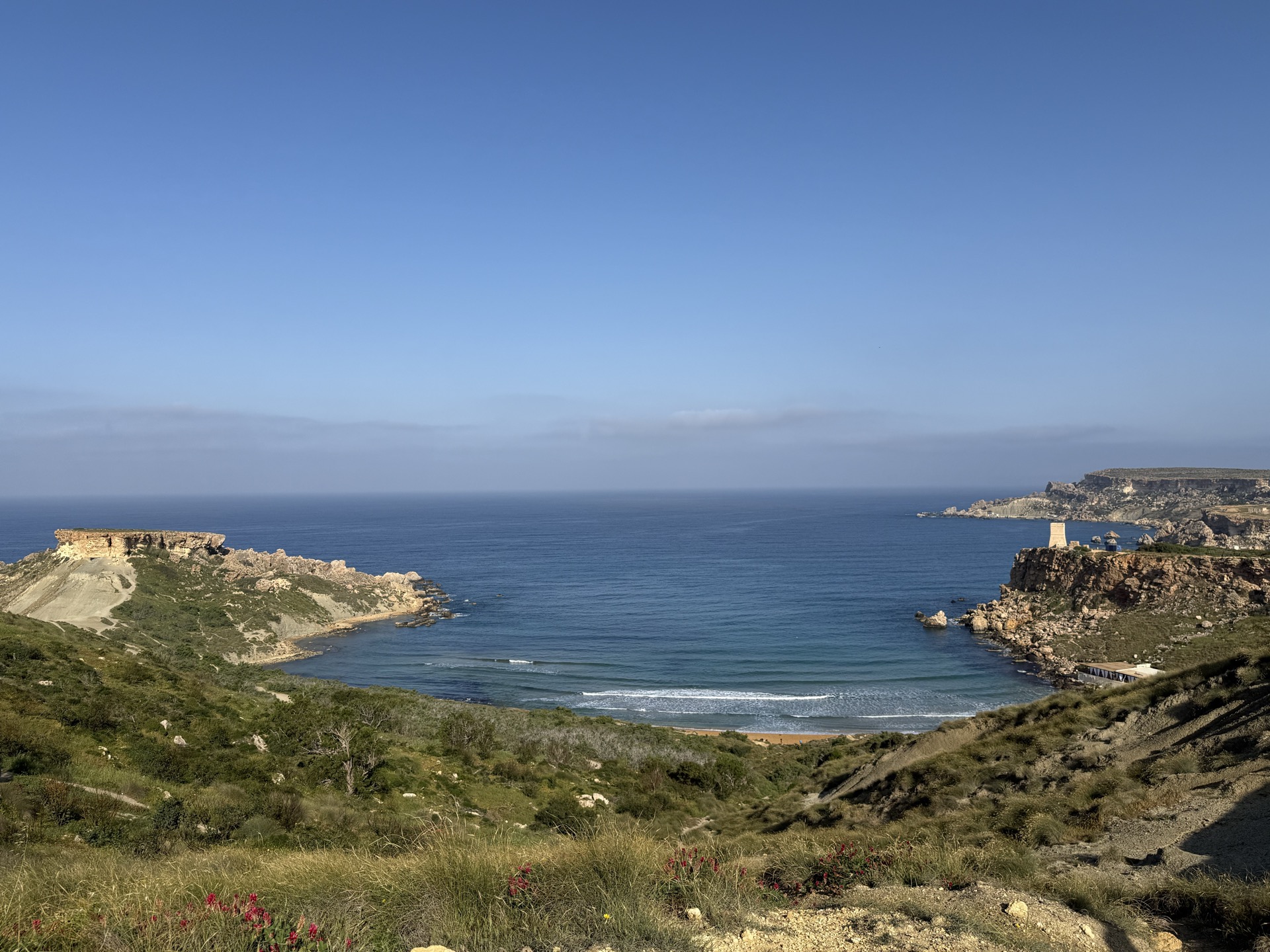
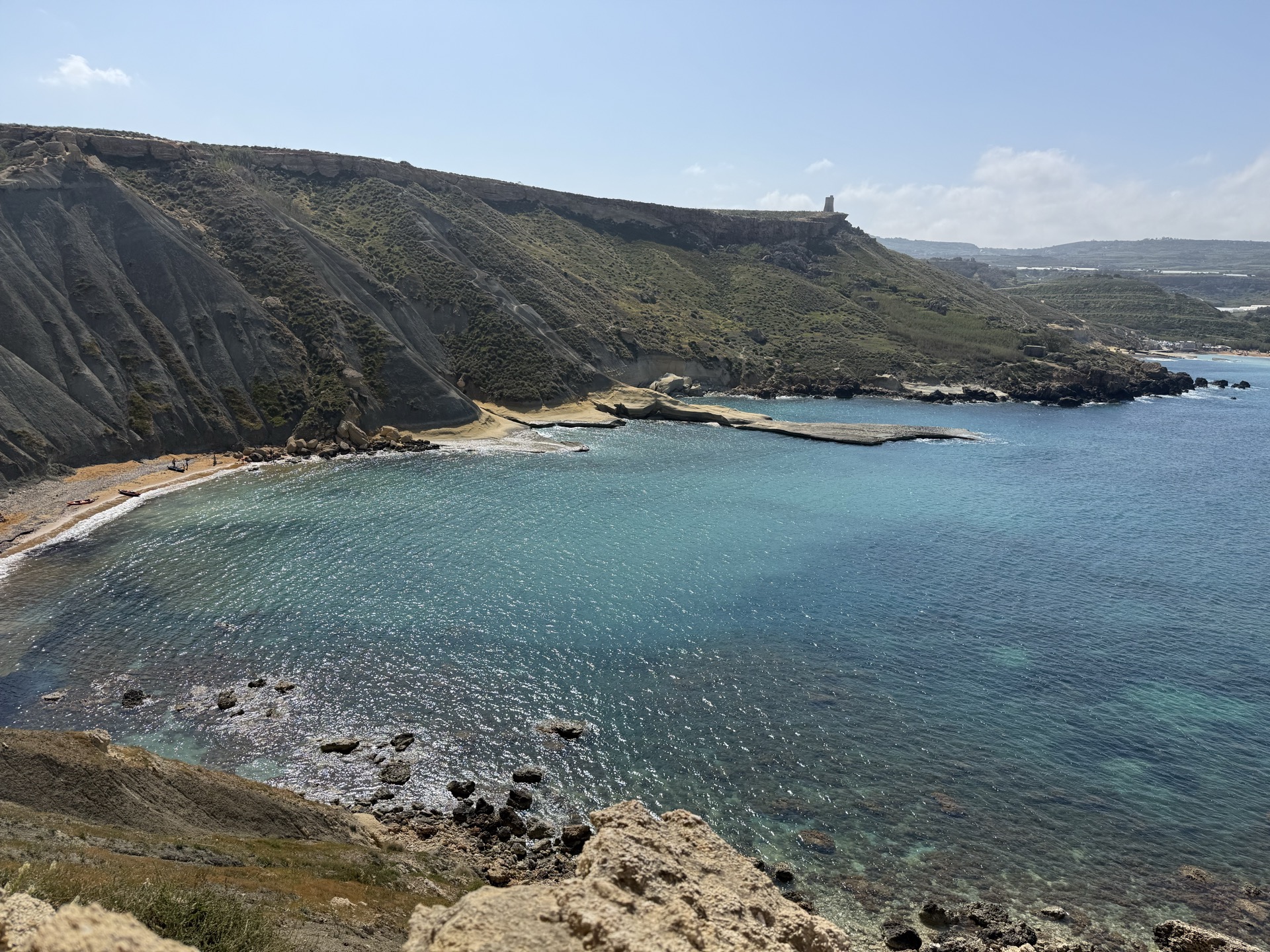
Halfway between Ġnejna and Għajn Tuffieħa there's a rocky peninsula that sticks out into the sea like somebody laid a giant sandstone table on the water. That's Qarraba. Most hikers pass it without going down because it adds forty minutes and a scramble.
Go down.
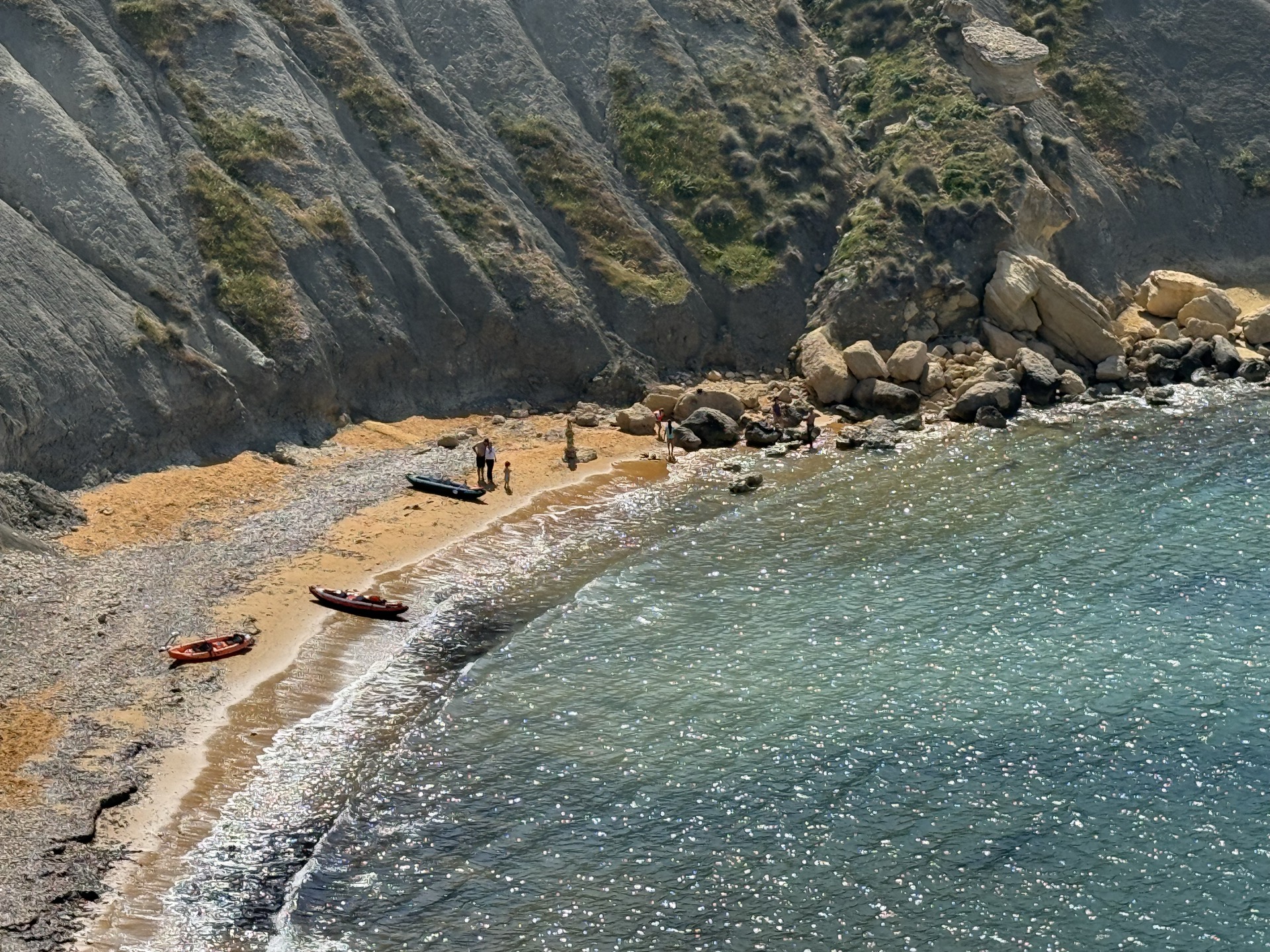
There's a tiny cove tucked into the north side of Qarraba that's only really reachable on foot or by kayak. Today there were two kayaks pulled up on the sand and maybe four other people. The water was glass. The cliff walls above it showed every layer of sandstone and mudstone Malta has — millions of years of deposition, visible in ten seconds of looking up.
If Għajn Tuffieħa is the postcard, Qarraba is the page you write something on.
Għajn Tuffieħa is the postcard, not the point
The famous red-clay steps down to Għajn Tuffieħa are what Malta tourism officially wants you to see. Eighty-something sandstone steps cut into the cliff, dropping into a crescent beach that shows up on every "hidden gem" listicle written by someone who hasn't been here.
It's not hidden. It's beautiful, and at 2pm on a Sunday in April, it was full of young couples taking photos of the steps and older British retirees doing the full Med-coast-stare from the sand. That's fine. It earns its reputation honestly.
But Għajn Tuffieħa is the middle act, not the climax. It's where you stop, drink water, notice that the sea is properly swimmable already even though nobody's swimming yet (too early — ask any Maltese). You don't stay. You climb back up and keep walking.
The erosion on the north cliff face is the thing to actually look at — layered sandstone stacked like badly-shuffled paper, slowly giving in to winter storms. Every year a bit more of it slides into the sea.
Golden Bay is where the island stops pretending
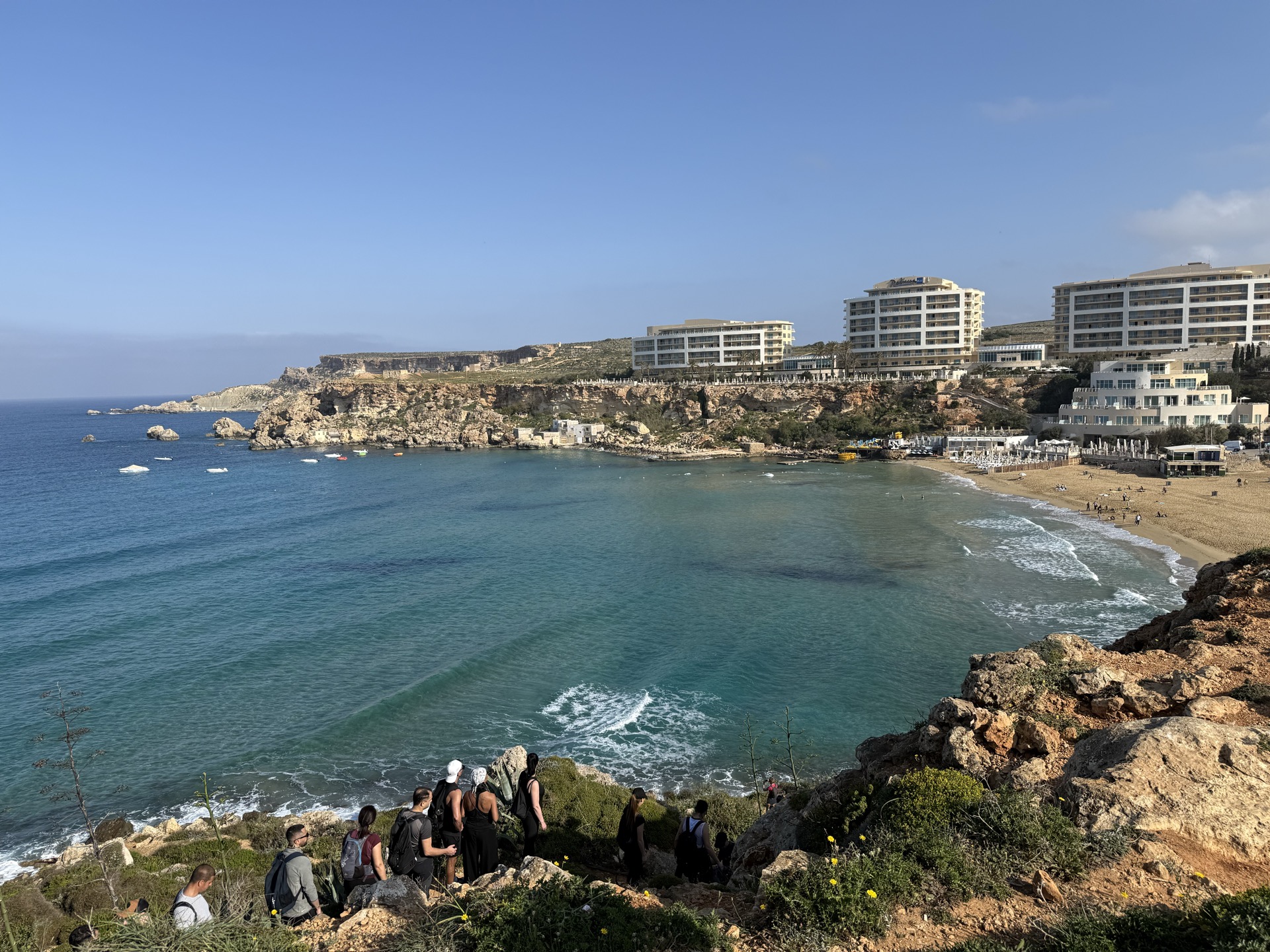
From the Għajn Tuffieħa side, you round one more headland and Golden Bay opens up. And so does the Radisson Blu. The beach is gorgeous — crescent sand, proper swimming water, lifeguards in summer. But the skyline is a resort block, a second resort block, a third resort block. That's the trade. Accessibility costs aesthetics. Always does.
If you walk the full loop we did, Golden Bay is where the other hikers appear — groups coming down from the Radisson side, couples from Mellieħa, families from the car park. It's the social part of the walk. You'll overhear four languages in fifteen minutes. That's also fine.
From here, you can loop back inland via Triq in-Naħħalija and Ta' Lippija Tower to close the circle back to Ġnejna — roughly an hour's walking through farmland and scrub. Or retrace the coast if you want more sea. We did the inland route back. The farmland is nicer than you'd expect.
What you actually need to know
- Distance: ~9 km as a loop (less if you cut out Qarraba or the Radisson headland). Allow 2.5–3 hours with stops.
- Start: Ġnejna Bay car park. Coming from Mġarr, follow signs for Ġnejna — the road ends at the beach.
- Best time: April–May and September–October. July–August is doable but start before 8am or wait until after 5pm — zero shade on the clifftop.
- Shoes: trainers are fine for most of it. Trail shoes if it's rained in the last 48 hours — the red clay near Għajn Tuffieħa gets properly slippery.
- Water: more than you think. No kiosks between beaches outside peak summer, and even then Ġnejna's van is unpredictable.
- Swim stop: Għajn Tuffieħa for deeper, cleaner water. Qarraba's cove if you want quiet and don't mind rocks.
- The Qarraba detour: adds 40–50 minutes including the scramble. Worth it. Don't skip.
The honest warning
The clifftop path has crumbled in a few spots between Qarraba and Għajn Tuffieħa. If you're hiking with kids or anyone nervous about exposure, stick to the inland diversion — it adds five minutes and removes the cliff edge. Don't be the person who has to wait for the marine police because you thought the photo was worth it.
There's a ritual to this walk, and nobody writes it that way. Nine kilometres of clifftop that changes every year — the erosion, the wildflowers, which bits of path have given way since last summer. You don't get this three-bay stretch anywhere else in the Mediterranean. Sandstone, clay, salt air, and the sea doing what the sea does. It's one of those walks that reminds you why people don't leave this island.
And the first time you do it in spring, after a winter of writing indoors and pretending the wind is bearable — that's the thing.
Summer in Malta doesn't start on a calendar. It starts on the three-bays loop.
Next weekend: Gozo. The other side. [INTERNAL LINK NEEDED: upcoming Gozo route post]